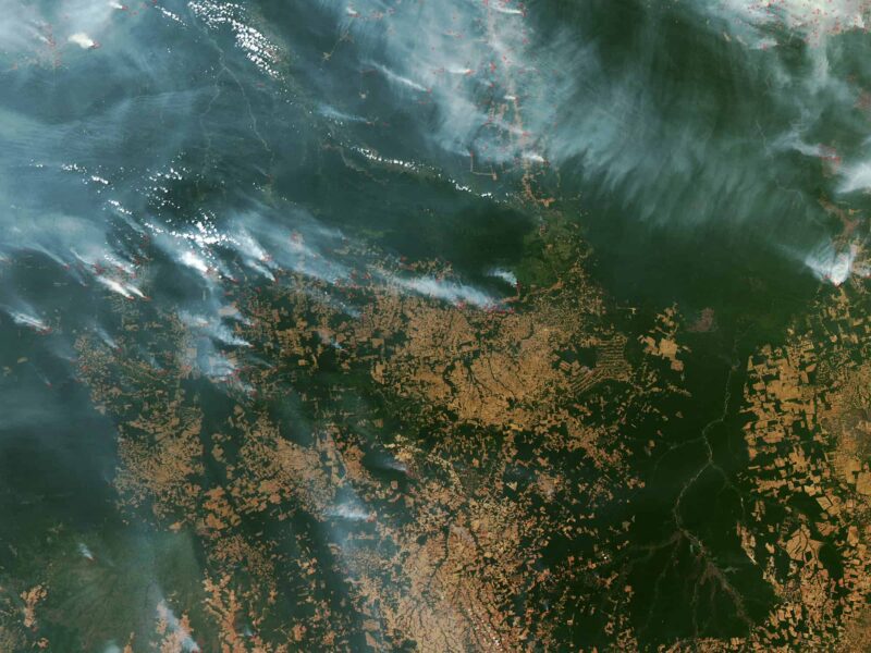
The recent fires in the Amazon have put deforestation in the headlines, with stories highlighting the important role the rainforests play in storing climate-changing greenhouse gases and the need for better policies to protect them.
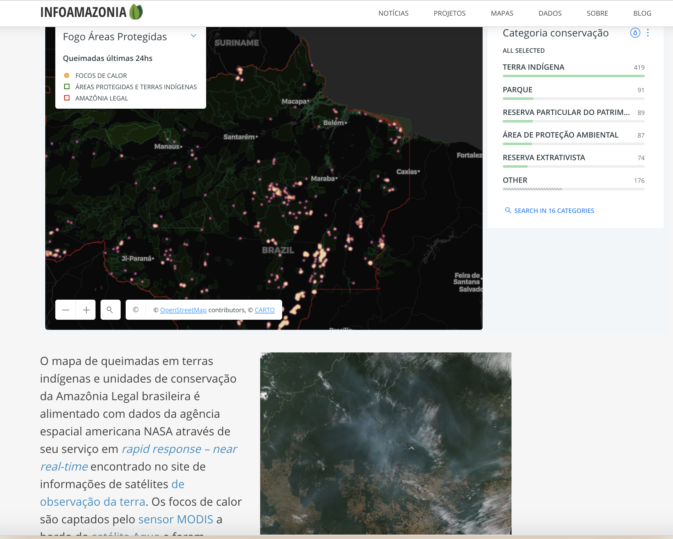
EJN partner InfoAmazonia, one of our flagship GeoJournalism projects, has long been on top of the issue, keeping an up-to-date map of fire spots that helps illustrate the true extent of the problem and allows for richer reporting on it.
In an Aug. 15th story, for example, reporter Gustavo Faleiros produced this report showing through detailed maps and infographics just how extensive the burning how been – and how connected fires are to deforestation. For example, seven of the cities in Brazil with the most fires are also on the list of those seeing the most tree clearing, the story says. The fires have also seen a rapid escalation in recent weeks, more than doubling in number as of Aug. 31 compared to the same period a year earlier, according to the Brazilian Institute of Spatial Research (INPE).
“Where there is smoke in satellite imagery, there is no source other than deforestation,” researcher Alberto Setzer from the National Space Research Institute’s Burn Monitoring Program, told InfoAmazonia.
Like many of our GeoJournalism platforms, InfoAmazonia hosts data-rich maps and geo-tagged stories that give context and narrative support to environmental issues. Its latest regularly updated map of burning in indigenous lands and protected areas reveals satellite images showing hundreds of fires continuing to burn even after Brazilian President Jair Bolsonaro signed a decree temporarily banning the use of fire for land clearing.
In recent weeks, our GeoJournalism work has allowed reporters to respond quickly to the fires, raised awareness about them and helped other media outlets to cover this important story. So great was the interest, in fact, that InfoAmazonia’s daily pageviews increased by up to 1,000 times during the last week.
“By supporting the general and open use of such mapping and data visualization technologies, EJN is giving journalists the ability to cover the environment more efficiently,” said Stefano Wrobleski, who serves as InfoAmazonia’s editor and EJN’s GeoJournalism coordinator.
(Banner photo: Fires in southeast Amazon. Courtesy of NASA Earth Observatory)